Archaeology Terms
Line Level Uses
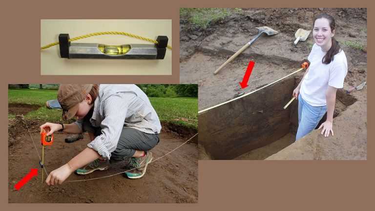 Line level uses Long before the arrival of laser levels and GPS, archaeologists used this simple, handy device to create a horizontal line for measuring. The “line level” shown in the photo (upper left) is a bubble level that hangs from a string. It’s still an essential part of most archaeologists’ toolkits. You can use chaining pins, nails, or even icepicks to hold the ends of the string wherever you want to have your line. You wind the string around one of the supports until it is taut and level. Now you have a horizontal “axis” line (right) and can measure up or down from it with a tape. This technique is useful for mapping soil differences in a vertical wall.
You can also use a line level to measure the depth of your excavation (lower left) and make sure the floor is level. To do that, you anchor a string at one corner of the unit, stretch it until it’s level, and measure down with a tape.
One other bit of string trivia: Regular string tends to unravel with use. “Mason’s line” string is braided rather than twisted, so it doesn’t unravel. It also comes in bright colors that are easy to spot in the field.
at the University of Wisconsin-La Crosse
Contact us
- 1725 State Street
La Crosse, Wisconsin 54601 USA - Call 608.785.8463
- Email us