Trempealeau
- Archaeological Investigations in Trempealeau, Wisconsin
- Mississippi Valley Archaeology Center at Trempealeau: The 1999 Field Season
- Hopewell Culture
- Frequently Asked Questions About Mounds
- Mississippi Valley Archaeology Center’s Excavations at Perrot’s Post
- Photographs: 1920’s and 1990’s
The information on this web page pertains to archaeological research conducted (from 1928 to 1999) at Perrot State Park, Trempealeau, Wisconsin. Archaeological research and interpretive displays installed at the park were the result of cooperative efforts between Mississippi Valley Archaeology Center at the University of Wisconsin – La Crosse and Perrot State Park. Funding was provided through a grant from the federal government in the form of a two year ISTEA (Intermodal Surface Transportation Efficiency Act) grant administered by the State of Wisconsin Department of Transportation with additional support from the University of Wisconsin – La Crosse. Images from the 1920’s excavations have been provided by the Milwaukee Public Museum. Learn more about archaeology done at the park, pre-European cultures and the early French occupation by visiting Perrot State Park’s Nature Center or by looking at the specific topics shown above.
Archaeological Investigations in Trempealeau, Wisconsin
Early Archaeological Investigations at Trempealeau
The earliest record of archaeological remains at the Trempealeau Bluffs are from early settlers such as James Reed, Lafayette Bunnell and August Grignon. Their recollections in later life provide few details, but make brief mention of earthen mounds in the area. Judge George Gale produced some of the earliest maps of mounds between Trempealeau and Galesville, and described a few specific mounds in Trempealeau in his 1867 book “Upper Mississippi”.
The decade of the 1880’s brought a flurry of archaeological activity at Trempealeau. This was initiated by Theodore H. Lewis a surveyor funded by philanthropist Alfred Hill of St. Paul. Together Hill and Lewis formed the Northwest Archaeological Survey, and during the 1880’s Lewis traveled throughout the Midwest mapping thousands of mounds. He visited Trempealeau in 1885 and again in 1888 making detailed records of a bird mound on Trempealeau Mountain and two deer across the bay near what is now the nature shelter of Perrot State Park. He also mapped rectangular flat-topped mounds overlooking the village of Trempealeau, and other animal shaped mounds towards Galesville. Lewis also recorded rock carvings on the sandstone ledges at the foot of the Trempealeau Bluffs, making rubbings of these and publishing an article in 1889. Most of the mounds and rock art sites recorded by Lewis have since been destroyed, and his records are the only information we have for many of these sites.
The 1880’s also saw the fortuitous discovery of a French trading post at the foot of the Trempealeau Bluffs. This discovery brought scholars from Trempealeau, Winona and the State Historical Society of Wisconsin. Local participants included Judge Benjamin Houston, Antoine Grignon, and avocational archaeologist George Squier. The find also brought T.H. Lewis back in 1889, and he published another article on his diggings here which included a detailed map of the layout of the post.
At the beginning of the 20th century, local avocational archaeologist George Squier became acquainted with State Archaeologist Charles E. Brown, resulting in a 15 year series of letters and articles that described in detail Squier’s surveying for archaeological sites in the Trempealeau area. Among Squier’s major contributions were maps of the mound complexes in what became Perrot State Park, descriptions of the French post investigations (including another excavation in 1912), and a detailed description of the platform mounds in the village along with distinctive pottery found in an adjacent camp site (which happened to be on Squire’s property). Squier’s accounts reveal that his archaeological insight was well ahead of his time.
In 1927, a mound was leveled on the Shrake farm in what is now the campground of Perrot State Park. Finds of interesting artifacts brought local artifact collector Ernest Bright to the site, where he recovered eleven chipped knives made of a clear brown flint, copper beads and earspools, bear canine teeth that had been drilled through to suspend as ornaments, and fragmented pottery vessels. These finds were brought to the attention of Will C. McKern at the Milwaukee Public Museum who brought a team to western Wisconsin the following three summers to conduct the first professional archaeological research in this region.
Milwaukee Public Museum at Trempealeau: The 1928 Season
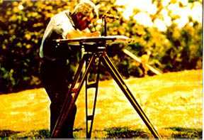 1920's SurveyTransit
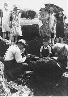
In 1928, McKern and his crew from the Milwaukee Public Museum (MPM) set up camp on the shore of Trempealeau Bay immediately below what is now the park’s nature shelter. From here they completed the excavation of the mound that Bright had opened the previous year, and began mapping other mounds in the immediate area. Using a surveyors transit the MPM team mapped 90 mounds in three clusters around Trempealeau Bay All but a linear and two animal-shaped “effigy” mounds were round or conical in form. Archaeologists at the time were trying to determine the age of the mounds and if the different shapes were constructed and used for similar purposes. During the summer of 1928, McKern’s crew excavated 17 of the mounds in these three groups, including both effigy mounds which were described as deer-like. The round mounds tended to contain several burials, some of which had elaborate artifacts with them. In contrast, the effigy mounds had few burials and few, if any, special artifacts.
Milwaukee Public Museum at Trempealeau: The 1930 Season
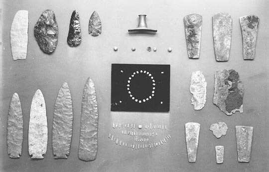 Special artifacts McKern returned to Trempealeau in 1930, focusing on a large group of mounds to the east of the village on the Schwert and Nicholls farms. Again, they began by mapping the twenty six mounds in this sprawling group. All were round cone-shaped, but one on the Nicholls farm dominated in size, standing nearly 12 feet high. Excavations were made in thirteen of the mounds on the Schwert Farm and in the large Nicholls Mound that summer. These investigations revealed a complex burial pattern in the conical mounds. Some mounds contained more than 10 burials while others had only a few. Most burials were placed in rectangular pits dug into the original ground surface and covered with a small bark structure. Later the burial structure was mounded over with soil scraped up from the surrounding area. With some individuals were special items including large chipped stone knives, copper axes, pipes, and ornaments. Most of these were made of materials that originated far away such as black volcanic glass called obsidian and other flints from the Rocky Mountains and Black Hills, copper from Lake Superior, and pipestone from western Minnesota. These indicated that the people buried in the Trempealeau conical mounds were involved in a broad trade network, and McKern recognized this as being a northern extension of the Hopewell Culture of Ohio and Illinois.
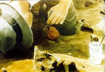 Excavating two pots
 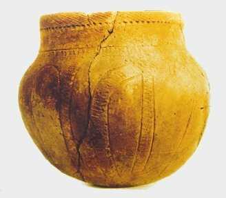 Pot
Pot
Mississippi Valley Archaeology Center at Trempealeau
By the 1990’s, archaeologists had learned a great deal about the age of past cultures through Carbon 14 dating. For example, we know that the Hopewell Culture dates from about A.D. 100-400 and that the Effigy Mound Culture dates from about A.D. 700-1100. Since about the 1940’s, archaeologists have shifted emphasis from mounds to camp sites, though very little work was done in the Trempealeau area with the exception of excavations by the State Historical Society in the mid 1960’s. What’s more, there had been no work done at the French trading post site since 1912, though it was marked as a historical site within Perrot State Park. In the meantime, a number of research questions had arisen. For example, did the people who built the mounds live adjacent to them. If so, did they live there all year, or only during the summer. Did they craft the special burial artifacts or where they traded in as finished artifacts from other Hopewell centers? As regards the French post, it was not clear if the post dated to Nicholas Perrot’s stay in the winter of 1685-86 or the arrival of Rene Linctot in 1731, or both. What’s more, it was not known if anything remained at all of the post. It was also obvious that many of the original mounds had been plowed down or otherwise obliterated during the intervening decades.
Mississippi Valley Archaeology Center at Trempealeau: The 1995 Season
In order to answer the modern research questions, MVAC archaeologists designed a strategy that began with a thorough review of historical records. These included tracking down the original letters, notes, and photographs of T.H. Lewis, George Squier and Will McKern. This helped avoid mound areas and identify portions of the French post that might remain intact. In addition, three non-invasive technologies were used to identify subsurface anomalies that might indicate intact remains. These were soil resistivity and conductivity surveys conducted by Keith Sverdrup, Department of Geoscience at the University of Wisconsin – Milwaukee, and ground penetrating radar survey by the Ho-Chunk Historic Preservation Office.
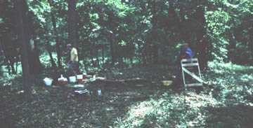
Finally, field work was initiated through systematic shovel testing which verified that artifacts existed in the areas selected for excavation. Using all of these background data, specific locations were chosen to conduct formal excavation squares or units, within which soils is carefully skimmed with flat shovels or trowels, and all of the soil screened. Excavations begin at the surface and proceed downward in levels so that the artifact locations are recorded both horizontally and vertically. That allows reconstruction of the site in the laboratory.
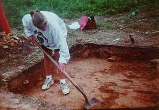 Excavation
 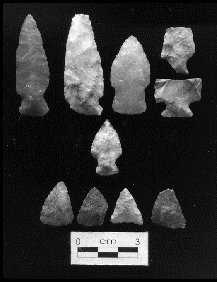 Projectile points
 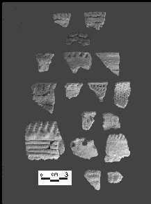 Pot sherds
In 1995 MVAC excavated a camp site on a peninsula south of the Shrake I mound group. Here they found scattered artifacts representing continuous camping from about 4,000 to 1,000 years ago. These included flakes from chipping stone tools, some spear tips, hide scrapers, and knives, broken pottery, burned limestone from fire hearths and charred hickory nut shells. All of the stone material found is available within 10 miles of Trempealeau, suggesting that burial artifacts made from non-local flints were not made here. On the other hand several lumps of copper were also found that may be related to making the copper axes or ornaments found in the mounds. The nut shell indicates a late summer-fall presence. Unfortunately, this site had been plowed for many years, and therefore, the artifacts in the top foot have been moved about many times. Below this level, several pits were found reflecting root cellar-like holes for storing materials and disposing of refuse. In one of these nearly half of a crushed pot was found along with charcoal that was dated by Carbon 14 giving a date of A.D. 860.
Mississippi Valley Archaeology Center at Trempealeau: The 1996 Season
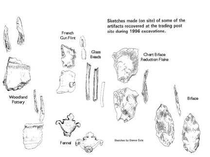
In 1996 MVAC returned to Perrot State Park, excavating two Native American camp sites and the site of the French post. One camp site is located near the sandstone ledge overlook. T.H. Lewis had recorded carvings of large hands and other images along this ledge back in 1889, but those were quarried away around 1900. MVAC began investigating this area through shovel testing the grassy slope behind the ledge. Artifacts were found in many of these test holes, and in June, a series of excavation units were opened. These excavations found that this area has been forested for thousands of years, and never plowed. Recovered artifacts included spear and arrow tips, pottery sherds, chipped drills and hide scrapers, and lots of waste flakes. These again reflect continual use from about 4,000 to 1,000 years ago.
 Left to right: mano, arrow shaft straightener, and a “plummet”
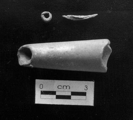 Clockwise from top: copper bead, copper awl (?), and a tube bead
The second Native American camp excavated is on the point immediately west of the Park nature shelter. Here shovel testing found a continuous scatter of camp debris. Excavations found some disturbances from historic camping, but much of the site was intact. The soils reflected a prairie environment. The artifacts represent use from about 4,000 to 500 years ago, including a series of pits that contained pottery, a grinding stone, arrow shaft straightener, and other materials of the Oneota Culture. The Oneota were the first intensive corn farmers in the region. Although some Oneota mounds are known from other areas, McKern’s excavations of the Trempealeau mounds did not find Oneota burials.
 Drawing of French artifacts
The 1996 investigations at the French post encountered a midden that contained thousands of bone fragments. All of the bone was from mammals, including buffalo, elk, deer, black bear, raccoon, and beaver. About half of the bone was burned, which often reflects cooking to extract marrow and other nutrients and suggests winter occupation. This agrees with the French records for both Perrot and Linctot as having been at Trempealeau during the winter season. In addition, mixed directly with the bone were several artifacts from the French era. These deposits demonstrate that the bone is from a French occupation although it is not yet known if the post dates to the Perrot camp in 1685-86 or the Linctot occupation in 1731-32.
Future Archaeology in Perrot State Park
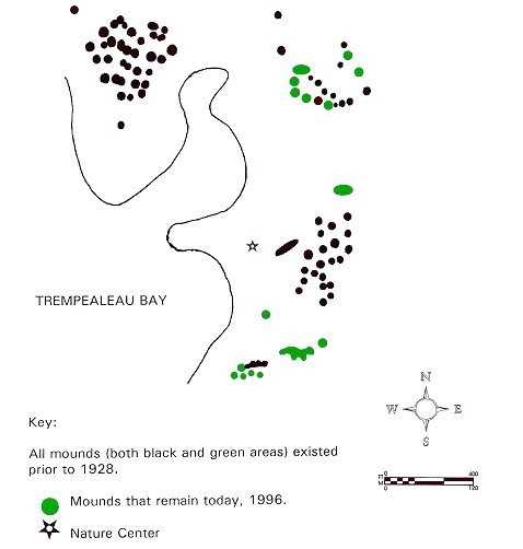 Map of mounds
 Mounds 1920’s
 Mounds 1990’s
Perrot State Park is not only a natural preserve but also contains non-renewable archaeological sites. The remains include mounds and camps from Native American Cultures dating back at least 4,000 years, and of historic resources most notably the site of one of the earliest direct contacts between Europeans and Native Americans along the Upper Mississippi River. Many of the mounds in the Trempealeau area, including those in Perrot State Park have been obliterated, though some remain. It is essential that we keep these from also being destroyed, while also working with local Native American tribes such as the Ho-Chunk to consider ways of commemorating those that have been damaged. Much has been learned about pre-European Native cultures from the 1995 and 1996 excavations, though these investigations lead to new questions. We have relocated the actual site of the French post and have demonstrated that portions remain intact. We can now assess how much remains; is their a fortification wall that can be traced and perhaps marked? and finally, can we determine the actual age of the post? These questions will involve more archaeology so that we can better understand the long heritage of Perrot State Park and the Trempealeau area.
MVAC at Trempealeau: The 1999 Field Season
by: Roland Rodell
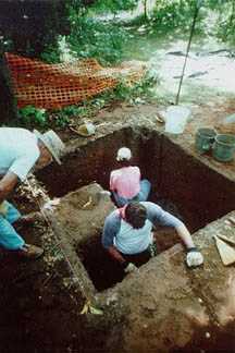
The purpose of the 1999 project was to address the ongoing need to emphasize public education with regard to the preservation and value of our cultural heritage, and to address issues regarding the management of cultural resources in Perrot State Park near Trempealeau, Wisconsin. The investigation of site 47Tr153 in Perrot Park provided an opportunity for the public to learn how archaeology is conducted and the importance of archaeological context for interpretation of a site.
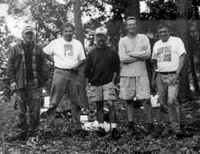 Group photo Members of the “Friends of Perrot,” a local nonprofit citizens group that promotes the activities in the park and provides volunteer services for various projects, were invited to join the excavation. Participants would learn how archaeology is conducted, what kinds of information can be derived from excavation, and the reasons for the investigation. Seven people participated in the field school that took place on the two consecutive weekends of July 31 – August 1, and August 7-8, 1999. The site selected for investigation is located in one of the more remote areas of the Perrot State Park , and is slowly deteriorating from water erosion of the shoreline.
The purpose of our investigation was to determine how much of the site area still exists. An excavation would provide insights on the archaeological integrity of subsurface deposits and obtain information about the culture history of the site.
Site Background
 Excavation In 1988, Robert Boszhardt examined an artifact collection from a site in Perrot State Park. The collection had an assortment of projectile points, including Paleo-Indian and Archaic types. The owner of the collection indicated that all the artifacts were found along the eroding shoreline and in the surrounding shallow waters. The collector identified the area that had been collected and described how artifacts were found by wading the shallow waters several feet out from the shore. The information provided by the collector suggested that a sizable portion of the site had already been lost to erosion.
A substantial portion of the collection is mounted on a board displaying 143 chipped stone tools and three ground stone tools. The variety of chipped stone points includes a couple examples of Paleo-Indian lanceolate points, along with several stemmed and notched base points from the Archaic and Woodland periods. Identifiable point types include a Hardin Barbed-like point, and Raddatz Side-Notched/Osceola/Godar varieties; Durst Stemmed, Madison Side-Notched, Waubesa Contracting Stem points and several small side-notched Late Woodland points. There are also some ovate bifaces, scrapers, and drills, some of which are modified projectile points. The three ground stone tools are two hammerstones and a grooved axe.
Investigations
 Excavation
Shovel Probe Survey: The investigation of 47Tr153 included a shovel probe survey and the excavation of four test units. The shovel probe survey dug 65 holes at five-meter intervals in order to identify artifact concentrations. A total of 320 artifacts were recovered from 50 (77%) of the 65 holes. Artifacts recovered include lithics, pottery sherds and a metal artifact. There are also some faunal remains. Among the lithics are a drill, a scraper, two biface fragments, a platform core, and a utilized flake.
Test Unit Excavations: Given the pattern of artifact distribution revealed by the survey, four 2 by 2 meter excavation units were staked out on the site. A summary of artifacts recovered from each unit is below.
| Unit | # of Lithics | # of Pottery | # of Historics |
| 1 | 364 | 28 | 1 |
| 2 | 681 | 117 | 0 |
| 3 | 1,238 | 320 | 1 |
| 4 | 305 | 48 | 1 |
Artifact Summary
The investigations of 47Tr153 have recovered a variety of artifact types that are clear indications the site was periodically occupied over several millennia. The site artifact assemblage, as represented in the private collection and the remains recovered by MVAC, includes an assortment of chipped stone tools that span the Paleo-Indian into the Late Woodland and Oneota periods. The presence of Middle Woodland, Late Middle Woodland, and Late Woodland pottery types, along with Oneota pottery, is further indication that a succession of cultural traditions utilized this location. There is also evidence of an early historic occupation.
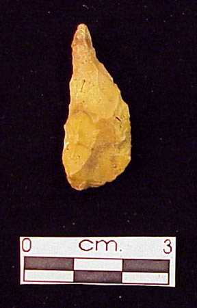
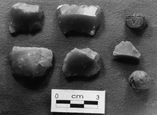
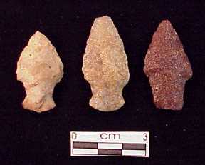 Projectile points
 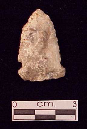 Projectile point
 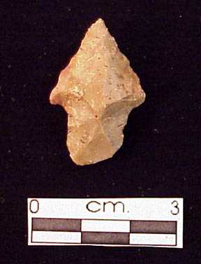 Projectile point
Lithics: There are six projectile points represented by three types from the Late Archaic-Early Woodland period: Durst Stemmed, Fox Valley Stemmed or Kramer-like, and Madison Side-Notched. The remaining tools are more difficult to date. The manufacture and use of chipped stone drills and scrapers extends deep into the Archaic period, and probably earlier. One of the drills appears to have been made from a projectile point, although the original point type cannot be determined. Both drills came from upper layers of the site setting, suggesting that they are late prehistoric. Scrapers do not become abundant in lithic assemblages in northern Mississippi Valley until the Oneota period. The 47Tr153 scrapers are small—possibly from use and re-sharpening—and given that they were recovered near the surface, in general co-occurrence with shell tempered pottery, these tools may be from an Oneota occupation. A caveat to this interpretation is that a Late Archaic-Early Woodland point was also found near the surface in Level 1 of Unit 4.
 Drill
Drill 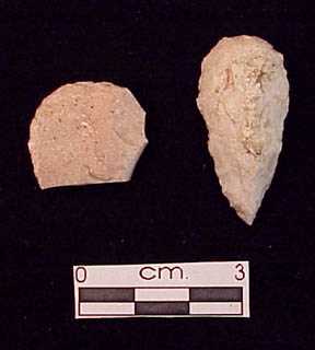 Scrapers
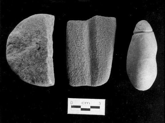
 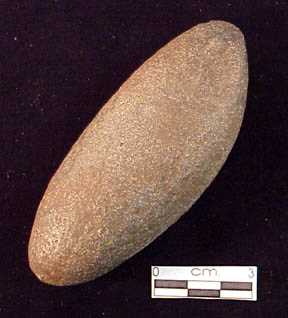 Celt
Celt 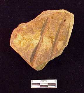 Abrader
The use of granitic rock to make ground stone tools spans the middle Archaic through the Oneota period. The celt and a hammerstone were recovered in Unit 3 at or below the levels with Late Archaic-Early Woodland points. These associations suggest that the ground stone tools are of the same period. The small hammerstone from Unit 1 was not in a context associated with diagnostic artifacts, although it was found near the surface suggesting the possibility of a late prehistoric age. A similar argument could also be made for the sandstone fragment with grooves.
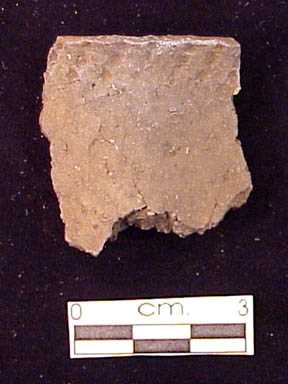 Pot sherd
 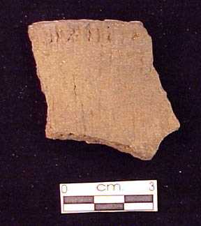 Pot sherd
 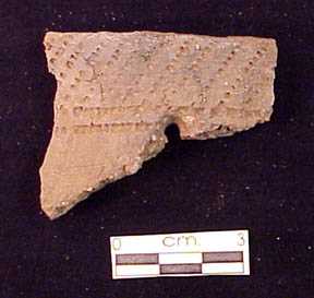 Pot sherd
Pottery: The 556 pottery fragments are divided between 535 (96.2%) grit tempered sherds and 21 (3.8%) shell tempered sherds. Twenty-four of the cord-impressed body sherds have design attributes, such as punctates, incised lines, or dentate stamping, and 16 of the smoothed surfaced body sherds display either tool incised lines or twisted cord impressions. These decorative elements are representative of Middle Woodland or Late Woodland pottery; however, none of the decorated sherds are large enough to confidently be identified with specific pottery types. On the other hand, the 13 rim sherds can be sorted into types or at least assigned to a general time period within the Woodland tradition. The rims divide into Middle Woodland types, Late Middle Woodland types, and Late Woodland types. All of the shell tempered sherds are small, and as typical of this ware group all have smooth surfaces. Six of the 21 sherds have one or two shallow incised lines. Unfortunately, none of the sherds are large enough to be identified with a particular Oneota pottery type.
Fauna: A variety of mammal, fish, turtle, and bird bones were recovered during the shovel probe survey and from the four excavation units. The sample is small and the excavations did not find any appreciable concentrations of remains.
Summary
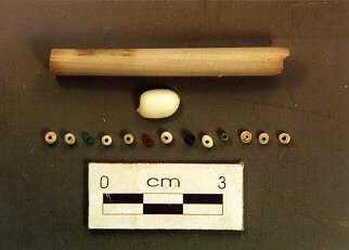
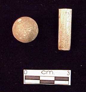 Clay marble and pipe stem
The 1999 MVAC investigation of 47Tr153 synthesized information derived from a private collection, shovel probe survey, and controlled excavation that identifies a multicomponent site with Paleo-Indian, Archaic, Woodland, Oneota and early historic occupations. Projectile point typology indicates that use of this site began with Late Paleo-Indian and continued through the Woodland period. Pottery typology has identified the presence of Middle, Late Middle, and Late Woodland, and Oneota occupants. And based on the presence of glass beads and the evaluation of a clay pipe stem there was a small historic component that appears to be pre-19th century.
Site 47Tr153 is not unlike other multicomponent sites in the area. MVAC excavations at other sites in Perrot State Park have found evidence for multiple occupations representing Archaic, Woodland, Oneota and historic occupations. How consistently site 47Tr153 was utilized over the span of several thousands of years cannot be adequately determined. There may have been prolonged gaps when no one visited this location. Most likely the site was occupied on a seasonal basis by small groups who hunted, fished, and gathered a variety of floodplain resources. Also, as indicated by the amounts of lithic debris, the manufacturing and re-sharpening of stone tools was clearly an activity that took place at this site. Even though fragments of pottery vessels were recovered from the site there is no evidence for pottery manufacturing.
Although the MVAC investigation found that a portion of 47Tr153 is still intact, shoreline erosion is slowly destroying the site. During the summer of 2000, the National Wildlife Refuge, which has control of the floodplain, had artificially lowered the water level exposing a bedrock shelf that borders the site. Although this temporarily alleviates the impacts of water erosion, the shoreline remains unstable. It is recommended that the National Wildlife Refuge and the Department of Natural Resources work together to stabilize this shoreline.
Site 47Tr153 is one of more than two dozen known archaeological sites in Perrot State Park. It illustrates that despite being located within the boundaries of a State park there is no guarantee of preservation. Prior to and during the duration of the grant period, MVAC personnel have worked with the DNR in both field and educational settings. Efforts to ensure preservation; however, should not be limited to the agency employees who manage the parks. Public involvement is essential. Providing hands on experiences like the MVAC field school is but one way of reaching the public. Field schools, however, can only handle small numbers of people. Larger audiences can be reached through public talks and tours by archaeologists, historians, or otherwise qualified and knowledgeable individuals who can address topics of the past and the issues of preservation and the need for maintaining the social and economic value of cultural resources.
Acknowledgements
Thank you to the employees of Perrot State Park, the Friends of Perrot and the field school participants for their help with this project.
Field investigations and archival research were conducted with the assistance of a grant-in-aid from the Office of Archaeology and Historic Preservation, U.S. Department of the Interior, under the provisions of the National Historic Preservation Act of 1966. The grant was administrated by the Historic Preservation Division of the State Historical Society of Wisconsin.
Hopewell Cultures
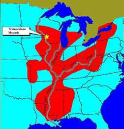 Map showing Hopewell influence
The Hopewell Culture existed in the Midwest from about A.D. 100-400. Although Hopewell influence extended from the Rocky Mountains to the Appalachians, core areas were located in restricted areas of Ohio and central Illinois. At each of these two centers, large mound complexes consisting of round “conical’ mounds and square or circular embankments existed representing enormous works of labor and social cooperation. Excavation of some mounds in the 19th and early 20th centuries found evidence of elaborate burial rituals. Often, Hopewell mounds were constructed over wood and bark structures, many of which were burned. Within rectangular pits, burials of several to many individuals were placed prior to mound construction. These included adult men and women as well as children.
Nicholls Excavations
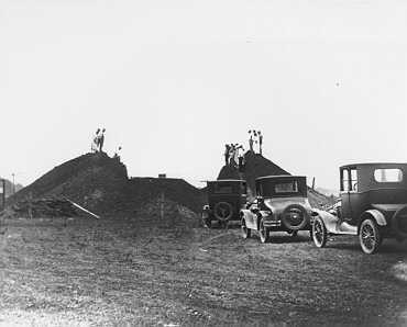 Excavation of Nicholls Mound
 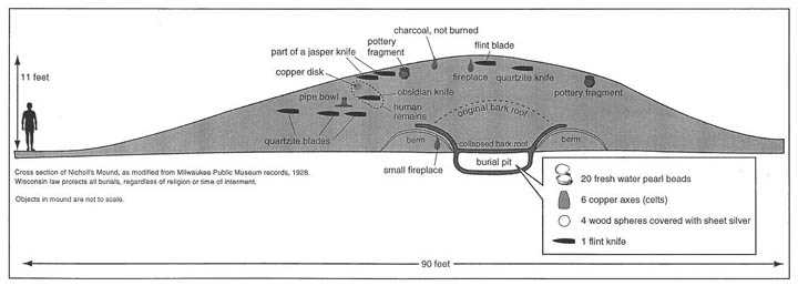 Drawing of cross section of Nicholls Mound
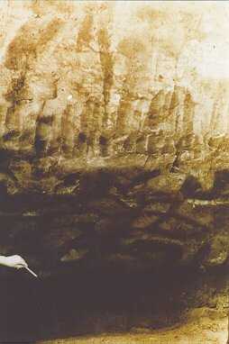
The Nicholls Mound was excavated by the Milwaukee Public Museum in the summer of 1928 under the direction of Will C. McKern. At that time, it was known that Wisconsin had several types of mounds including round conicals, animal shaped effigies and square platforms, but it was not known what these differences meant. Where they made for different purposes such as tombs, territorial markers, or platforms for the elite? or did the different shapes reflect changes in time. During the 1920’s and 30’s the Milwaukee Public Museum set out to answer these basic questions by excavating different mound types across the state. While at Trempealeau, the Milwaukee team excavated both conical and animal shaped mounds. The Nicholls Mound was the largest of the conical mounds in the area.
 Pockets of different colored soil
 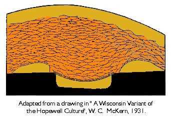 Drawing of pockets of different colored soils
 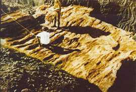 Bark layer
The excavation proceeded by establishing a site grid and mapping the mound. The central portion of the mound was then excavated in steps to reach the floor. In the mound fill the excavators could see pockets of different colored soil, each representing a basket load of earth. At the floor, the team encountered a layer of preserved bark, and carefully cleaned this for photographing and mapping. Upon removing the bark layer, a burial chamber was exposed. The chamber was a rectangular pit that had been dug into the original land surface, lined with bark, and covered with a bark roof. Within the pit, the excavators found several burials. They painstakingly removed soil to uncover each skeleton with associated artifacts and again photographed and mapped these. The artifacts and records were taken back to the Milwaukee Public Museum and were used to prepare McKern’s 1931 classic report: “A Wisconsin Variant of the Hopewell Culture”.
Hopewell Trade Network
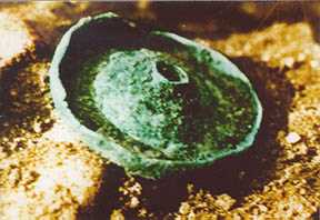 Ear spool
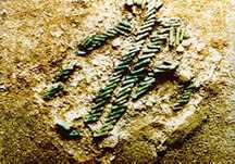 Copper beads
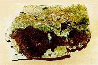 Copper breast plate
The people in Hopewell tombs were often buried with exotic artifacts including large chipped stone knives, copper axes, sheets of mica cut into detailed forms, stone pipes carved into a variety of forms including intricately detailed animals, special pottery vessels, and ornaments made from copper, shell and other materials. The materials from which many of these artifacts were made were not available locally, and some originate hundreds of miles away. For example, black volcanic glass “obsidian” outcrops in the Yellowstone area of northwestern Wyoming, yet chipped artifacts of this material was included in Hopewell tombs. Copper comes from Lake Superior, mica from the Appalachian Mountains, and marine shell from salt water oceans. These materials reveal Hopewell involvement in an extensive trade network. Along the way, other local Hopewell centers developed, including one at Trempealeau. These secondary centers do not have the complexity, quantity, and quality of the Ohio and Illinois centers, but artifact styles clearly indicate sharing of Hopewell ideas.
Frequently Asked Questions About Mounds
Do all mounds contain burials?
No. Most of the larger conical mounds appear to be from the Hopewell Culture and do contain burials. Later animal-shaped or “effigy” mounds sometimes contain burials, but some that were excavated did not. The two effigy mounds excavated in Perrot State Park did contain several burials. Platform mounds of the Mississippian Culture appear to have been constructed primarily as foundations upon which houses were built. A series of these overlooking the Village of Trempealeau were never excavated.
How many mounds were in Wisconsin?
We do not know the exact amount of mounds that were built within Wisconsin. Based on surveys from the 1800’s archaeologists estimate the number to be somewhere between 15 and 20,000. A recent assessment estimates that over 80% or at least 12,000 were plowed down or destroyed through town and city development in the last 150 years.
Are all mounds alike?
Mounds were constructed in a variety of forms, at different periods of time, and for different reasons. The earliest mounds of the Hopewell Culture are round or “conical” and were constructed primarily as burial tombs. Later “Effigy” mounds were built in shapes such as birds and other animals, only a few of which we recognize. Others are more abstract, and some are geometric. While some of these do contain burials, some do not, and their purpose remains a mystery.
Why did people build mounds?
Mounds were constructed by many different peoples, probably for many different reasons. Many mounds were built as tombs. The mound served not only to dispose of the dead but the communal effort of mound construction also served to reinforce social bonds. The mound itself stood as a marker not only of the dead but of the living culture, clarifying to all that this is our land and that of our ancestors.
How long did it take to build a mound?
This depends on the size, and there have been only a few experiments to replicate this effort. Those studies suggest that a group of about 20 people could construct a small mound with basket loads of earth in one day. Larger, more elaborate mounds obviously took more people and time.
MVAC’s Excavations at Perrot’s Post
History of the Post
In the fall of 1685 Nicholas Perrot and a small party of Frenchmen beached their canoes at Trempealeau, Wisconsin, where they built a protective shelter in preparation for winter. Several weeks earlier Perrot and his men had left Green Bay and crossed Wisconsin via the Fox and Wisconsin Rivers to reach the Mississippi Valley. The purpose of this expedition was to establish alliances with the Ioway and Dakota Indians in order to expand French interests in the fur trade market. Although Perrot’s venture was not the first French excursion into the upper Mississippi Valley, his was the first attempt to establish a foothold in this region. In the spring of 1686 the Trempealeau site was abandoned for a more advantageous location along Lake Pepin where Perrot built Fort St. Antoine. Over the next thirty-five years French economic fortunes in the upper Mississippi Valley waxed and waned. It was not until 1731, and the end of the Fox Indian wars, that the French under the command of Rene Godefroy sieur de Linctot returned to Trempealeau and established another trading post.
Early Excavations at the Post
Neither Perrot nor Linctot recorded where at Trempealeau they located their respective sites, although it is believed that Linctot’s post was constructed in the same location of Perrot’s winter camp. The desire by historians and archaeologists to discover the location(s) of these French occupations peaked in 1887 when workmen grading a new road bed for the Chicago, Burlington, and Northern Railroad uncovered two fire places. By late 1888 a series of small scale excavations had taken place uncovering more fire places, the earthen foundations of walls, and an area identified as a blacksmith’s forge. Among the artifacts were scraps of iron, gun parts, and nails that were identified as being of 17th and 18th century French origin. Other remains included metal arrow points (most likely made by the French to trade to the Native Americans), and the bones of mammals. Unfortunately, by today’s standards, these excavations were poorly organized and conducted by different parties. Some to the artifacts were sent to the State Historical Society in Madison; however, others went to a private museum in St. Paul and undoubtedly some were kept by individuals who dug at the site. Recent efforts to relocate these remains have so far been unsuccessful.
Maps of the Post
A result of these early investigations are three sketch maps of the site setting. Unfortunately, two of these maps are rather vague, lacking information about the layout of the site. A third map, however, has proven to be very insightful. It was recorded in 1888 by Theodore Lewis, an archaeologist who spent several years mapping archaeological sites in the upper Mississippi Valley. Lewis’s map accurately depicts the locations of the excavated fire hearths and earthen berms (the remnants of structures) in relationship to the railroad tracks and bank of the Mississippi River floodplain.
Preserving the Post
In 1918 preservation of the site was insured with the establishment of Perrot State Park. The first of two historical markers commemorating the site was dedicated in 1926. A second interpretative marker, recognizing the French occupations and the work of the early investigators, was erected in 1964.
Mississippi Valley Archaeology Center at the Post
 Excavation
The Mississippi Valley Archaeology Center investigation was prompted by the dearth of information about the site known as “Perrot’s Post.” This void is not simply an absence of artifacts, but more importantly there exists among researchers and the public a poor understanding of the culture history of the site. As an initial step to rectify this situation a cooperative agreement was established between MVAC and Perrot State Park. Our efforts through this arrangement secured federal funding in the form of a two year Intermodal Surface Transportation Efficiency Act (ISTEA) grant. The grant application and award was administered by the State of Wisconsin Department of Transportation. Their help and patience in guiding us through the application procedures is gratefully acknowledged.
In July of 1995 and 1996 MVAC conducted two week field projects. Teachers, high school students, and the lay public participated in these archaeological investigation. They experienced both the rigors of fieldwork and the thrill of discovery. Several square meters were excavated and hundreds of artifacts were recovered. The majority of these remains are artifacts of chipped stone and fragments of pottery representing periodic Native American occupations of the site, spanning several thousand years before the arrival of Europeans. Numerous other remains, such as nails, spikes, glass, and wire, are from the past 150 years and represent railroad, farming, and park activities.
 Gunflings, Jesuit ring and lead musket ball
 Glass beads
In comparison to the Native American and recent historic remains, evidence of the French occupation(s) is sparse, however, it is no less important. The MVAC excavations recovered French artifacts that were not encountered, missed, or simply not reported by the earlier digs. These included French made gunflints, several glass trade beads, a Jesuit ring, and other metal artifacts we believed are from the French occupation, such as a knife blade and a musket ball. Our excavations also uncovered where the French dumped their garbage. The location, on the west side of a earthen berm, would have been outside of the structure. This deposit of garbage is immediately below the modern ground surface and only a few inches thick. From it we recovered the bones of black bear, beaver, and raccoon, along with hundreds of small bone fragments. Mixed among these remains were some of the gunflints and glass beads.
Our investigations did not simply reaffirm the location of the French occupation(s), but recovered remains heretofore not reported for this site. In addition, the excavation identified more precise information regarding the location of a structure from the French era. This information correlates with some of the features mapped by Lewis over a century ago. Our view is that most, if not all, of the French remains are from the Linctot occupation.
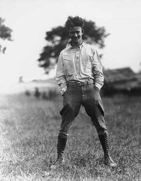
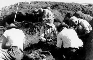
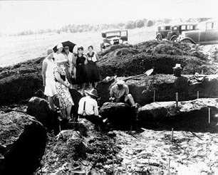
Photographs: 1920’s and 1990’s
The photographs show how excavation techniques have changed. Technology has change how some things are done but the goal of archaeology remains the same – to discover how people lived in the past.
Surveying
1920’s Survey transit 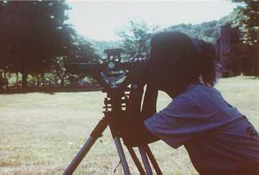 1990’s Survey
Shoveling
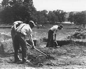 1920’s Shoveling 1990’s Skim shoveling
Equipment Movers
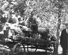 1920’s Equipment movers
 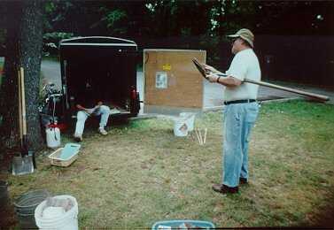 1990’s Equipment movers
Dirt Movers
 1920’s Dirt movers
 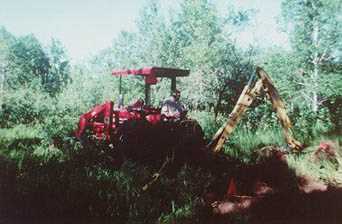 1990’s Dirt movers
People
 1920’s People
 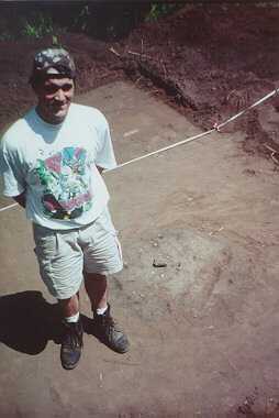 1990’s People
Onlookers
 1920’s Onlookers
 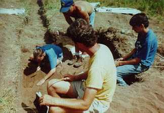 1990’s Onlookers
Lunch
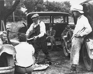 1920’s Lunch
 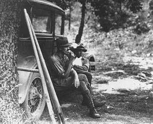 1920’s Lunch
 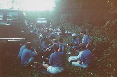 1990’s Lunch
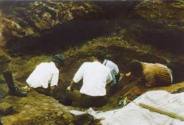
Excavation #1
 1920’s Excavating
 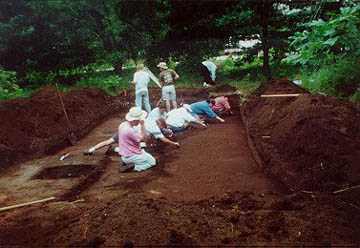 1990’s Excavating
Excavating #2
 1920’s Excavating 1990’s Excavating
Excavating #3
 1920’s Excavating
 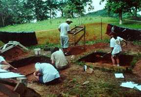 1990’s Excavation
Excavating #4
1920’s Excavating 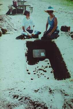 1990’s Excavation
Excavating #5
 1920’s Excavating
 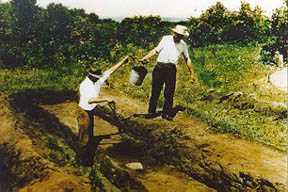 1920’s Excavating
  1920’s Excavation
 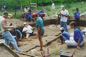 1990’s Excavation
at the University of Wisconsin-La Crosse
Contact us
- 1725 State Street
La Crosse, Wisconsin 54601 USA - Call 608.785.8463
- Email us